Both the Tigris and the Euphrates originate in the mountains of Armenia and eastern Anatolia; both end in the Persian Gulf. The Tigris takes a direct route to the Gulf whereas the Euphrates cuts south until it is separated from the Tigris by more than 250 miles of steppe. This broad region, which lies today in eastern Syria and western Iraq, was the Aram Nahraim (“Aram of the Two Rivers”) mentioned in the Bible. The two rivers draw near again until they come within 20 miles of each other, near Baghdad, before diverging a second time. Crucially, the Euphrates is 30 feet higher than the Tigris, facilitating the cutting of channels between the two rivers which could be used for transport and irrigation.1Lloyd 1984, 16
Thank to the proximity of the Tigris and the Euphrates, this region of Mesopotamia has always enjoyed a strategic advantage. Thus it is not an accident that the capital cities of Mesopotamia in all ages, namely Kish, Babylon, Akkad, Seleucia, Ctesiphon, and Baghdad, were all located in what William Hallo refers to as the “capital district” of Mesopotamia.2Hallo 2010
Contributing also to the strategic importance of this region is the confluence of the Tigris and Diyala rivers. The trade route which followed the Diyala River penetrated into the eastern Zagros mountains before turning south towards Susa thus connecting Elam with Mesopotamia.
An archaeological team from the Oriental Institute in Chicago excavated several important cities in the Diyala valley during the 1930’s, including Tell Asmar (Eshnunna), Tell Agrab, and Khafajah (Tutul). Attached to these excavations were a number of famous scholars, including Henri Frankfort, Seton Lloyd, Thorkild Jacobson, and Pinhas Delougaz.
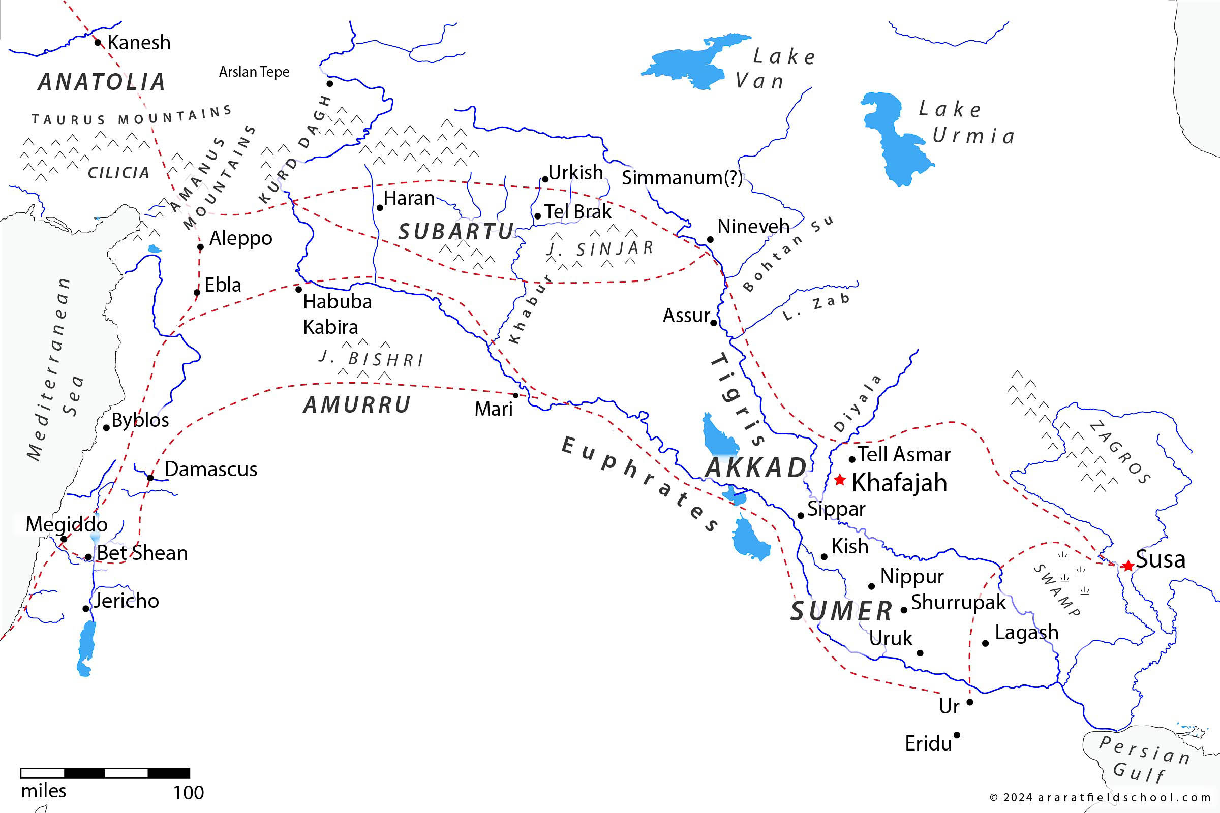
The plain of the Diyala was the gateway to an important pass through the Zagros mountains which led to Susa.
The Temple Oval
Of the three major sites excavated by the American expedition in the Diyala Valley, Khafajah was the most important. Excavations at the site were directed by Pinhas Delougaz, who gave priority to the most prominent structure at Khafajah, known as the “Temple Oval.” Delougaz traced the building and rebuilding of the Temple Oval through three major phases, beginning in the first half of the Early Dynastic period and continuing through the Akkadian. Undoubtedly, the most remarkable aspect of the oval was the twenty six feet of pure sand upon which it was constructed.3Sand may seem like a poor choice for the foundations of a building, but it is suitable as long as it is contained by perimeter wall or pit. See Josephson, “The Use of Sand-Box Foundations in Ancient Egypt” Delougaz suggests that approximately two million cubic feet of earth had to be removed and an equal amount of clean, white sand brought in to replace it. The sand must have been transported some distance since there are no known supplies of sand in the area today. The removal of so much earth and the transportation of such a large volume of sand “would be a considerable task even in modern times with all the engineering and transport facilities now available and certainly stands out as gigantic for the period in which it was achieved.”4Delougaz 1940, 17 As you may recall, the temple constructed on the mound at Hierakonpolis in Upper Egypt was likewise constructed on pure white sand that had to transported there for that purpose.
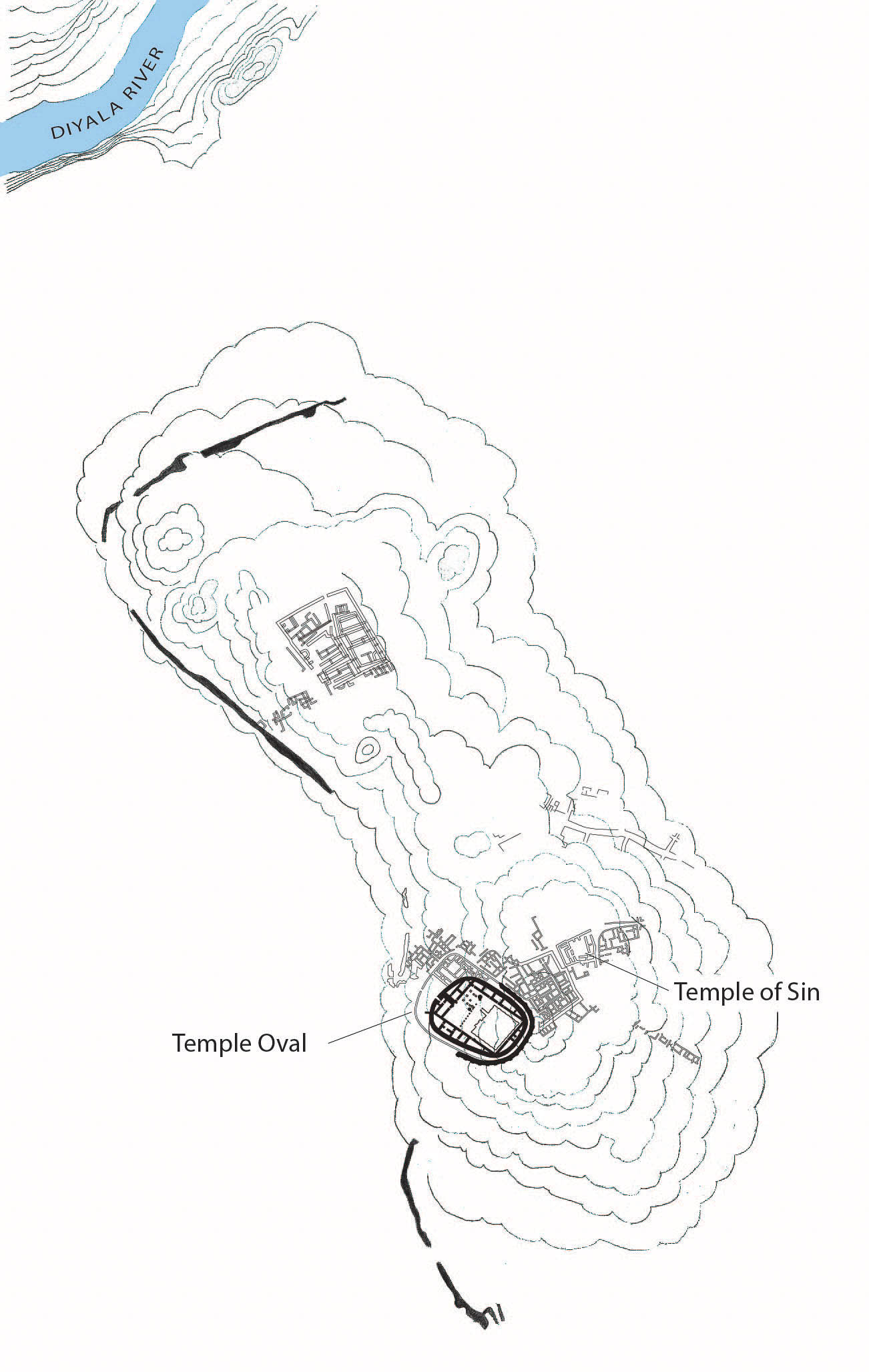
The Temple Oval is the most impressive structure at the site. However, the Temple of Sin was the more ancient of the two, with occupational levels going back to the Uruk period.
The Chalcolithic and Early Bronze villages situated in the Diyala Plain are buried under approximately thirty feet of sediment. The broad distribution of this sediment across the plain suggests that the river once fanned out across the plain rather than flowing through a single deep channel, as it does today.5Adams 1965, 6-11
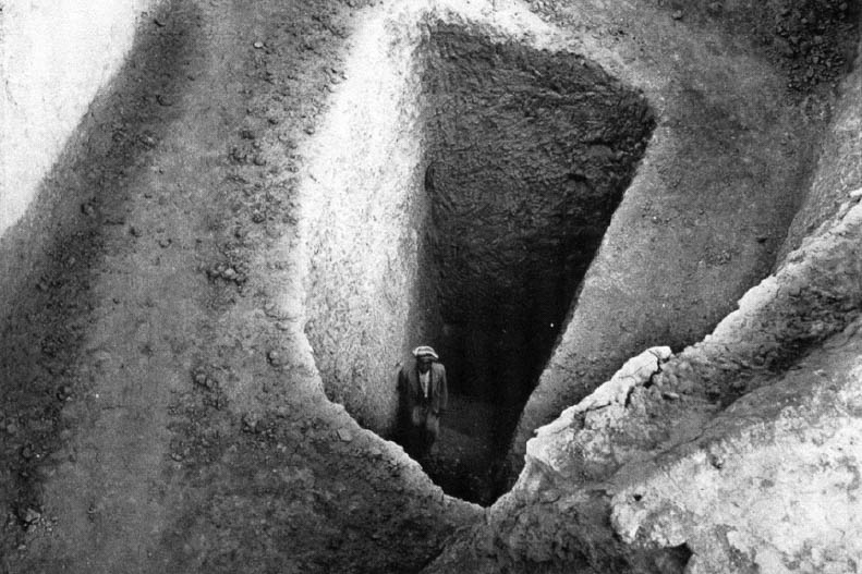
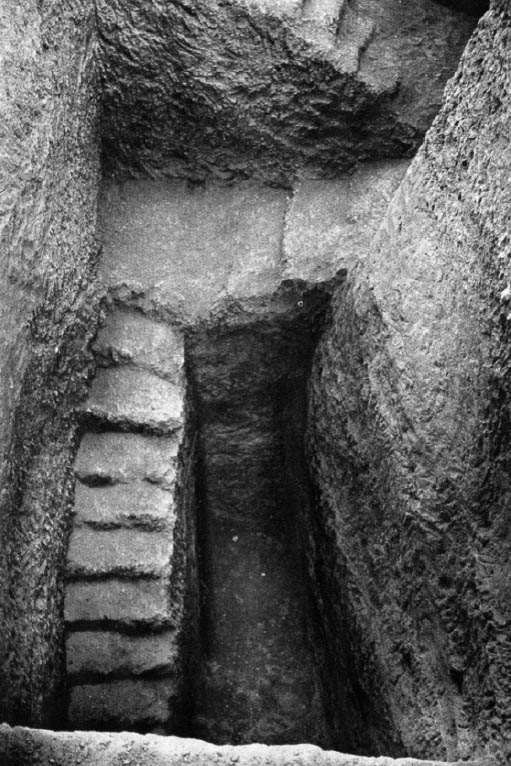
Pits such as these were dug into the mound in several places to determine the depth and extent of the sand which underlay the walls of the enclosure.
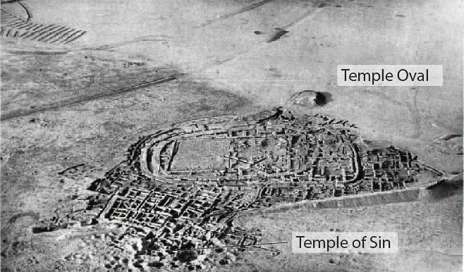
This picture shows the Temple of Sin before excavations were initiated. The robber pits are clearly visible in the photo, a sure indicator that something important lay below. The Temple Oval was largely exposed by this point.
Aharoni, Yohanan.
The Land of the Bible: A Historical Geography, translated by A. F. Rainey.
London and Beccles : William Clowes and Sons, 1967.
Delougaz, Pinhas , Seton Lloyd, Henri Frankfort, Thorkild Jacobsen.
Pre-Sargonid Temples of the Diyala Region. OIP 58 vols.
Chicago: The University of Chicago Press, 1942. Link
Delougaz, Pinhas.
Temple Oval at Khafajah. OIP Vol. LIII vols.
Chicago, Ill: University of Chicago Press, 1940.
Hallo, William W, William K. Simpson.
The Ancient Near East: A History.
: Harcourt College Publishers, 1998.
Hallo, W.
The World’s Oldest Literature : Studies in Sumerian Belles-lettres. .
Leiden, Boston: Brill, 2010.
“The Use of Sand-Box Foundations in Ancient Egypt.” Austriaca. September 21, 2024. Link
Lloyd, Seton.
The Archaeology of Mesopotamia.
London: Thames and Hudson, 1985.
McC. Adams, Robert.
Land Behind Baghdad: A History of Settlement on the Diyala Plains.
Chicago, Ill: University of Chicago, 1965. Link