
Looking from the direction of cemetery HK6 eastwards, towards the Nile, the site of Hierakonpolis is a barren desert today but in ancient times it was a bustling metropolis.
For the whole period of its existence, ancient Egypt was divided into an
“upper” southern region and a “lower” northern region. This naming convention is confusing since we are used to thinking of north as “up” but the Egyptians orientated themselves towards the source of the Nile, which was in the south. This was the most important geographical reference point for them and, theoretically, it was “up” on their maps. John Wilson notes that in the Egyptian language, “one of the terms for ‘south’ is also the term for ‘face’ while the usual word for ‘north’ is probably related to a word which means the ‘back of the head.'”1Wilson 1977, 43 The direction of the flow of the Nile from south to north became so fixed in the minds of Egyptians that they had a hard time conceiving of another great river that flowed in the opposite direction. Thus they referred to the Euphrates as “that inverted water which goes downstream by going south.”2Wilson 1977, 37

The Nile passes through regions of barren desert in the Sudan on its journey north. This picture was taken between the third and fourth cataracts.
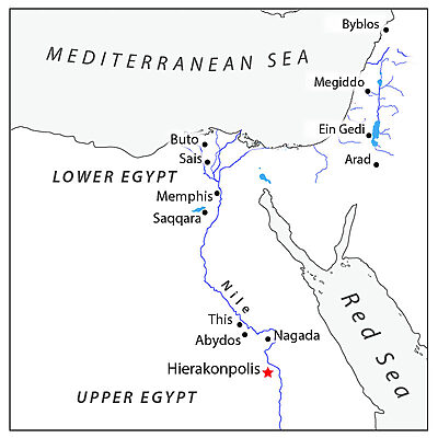
Upper Egypt is mostly desert with only the narrow flood plain on either side of the Nile available for farming. In contrast, Lower Egypt is a broad, fertile delta capable of supporting a large population. Egypt’s political center was, for most of its history, located in the Nile delta. However, many of its most important ruling dynasties originated in the south, including its earliest dynasties, which arose along a stretch of the Nile between Hierakonpolis and Abydos. Situated between them, where Nile River bends sharply to the east, was another important center known as Naqada, which gave its name to the period of state formation in Egypt known.
| Period | Era | Culture | Standard | AFS | Comments |
|---|---|---|---|---|---|
| Chalcolithic / EB I | Badarian | 4500-4000 BC | |||
| " | Naqada I | Amratian | 4000-3600 BC | ||
| " | Naqada II | Gerzean | 3600-3300 BC |
| |
| " | Naqada III | Protodynastic | 3300-3100 BC | 2800-2600 BC |
|
| EB II | Dynasties I & II | Early Dynastic | 3100-2700 BC | 2750-2500 BC |
|
The absolute chronology for this period ultimately hinges on how much weight one is willing to give to radiocarbon dating and on assumptions about how long it took for human cultures to develop technological skills. This is especially true for the earliest periods. The alternative dates presented in the ‘Ararat’ column rely on a low chronology for Mesopotamia1Gasche et al. 1998 and on synchronisms between the Uruk period in Mesopotamia and the Predynastic period in Egypt.
The Site
Hierakonpolis is the largest and most important predynastic Egyptian city excavated to date. Its name comes from the Greek and means “the city of the falcon” after the falcon god, Horus, whose temple was located there. However, the Egyptians referred to the city as Nekhen.
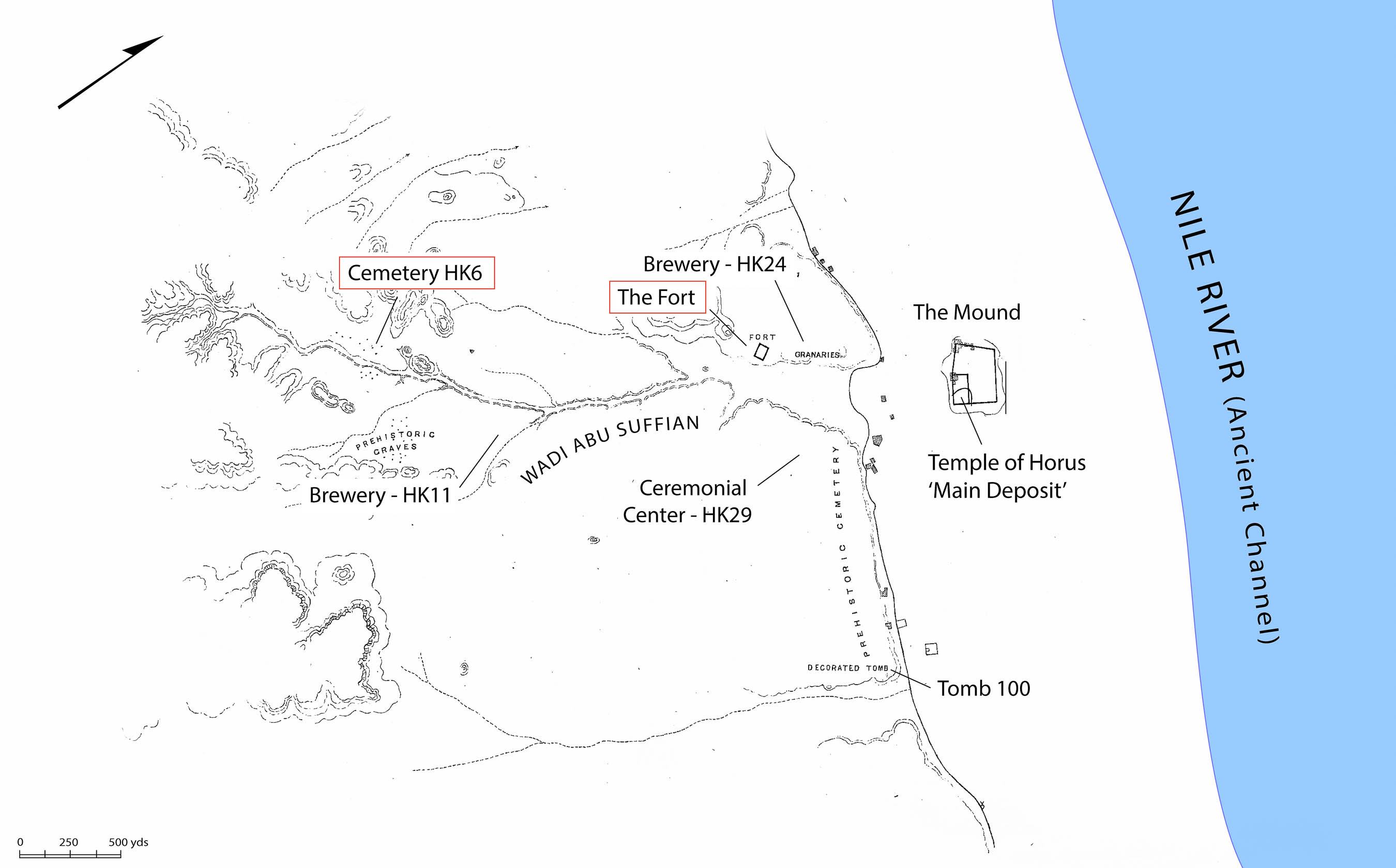
Hierakonpolis may be divided into three major areas: 1) the main mound located on the flood plain; 2) the low desert adjacent to the flood plain; 3) the elite cemetery (HK6) and settlement (HK11) located approximately a mile up the Wadi Abu Suffian.
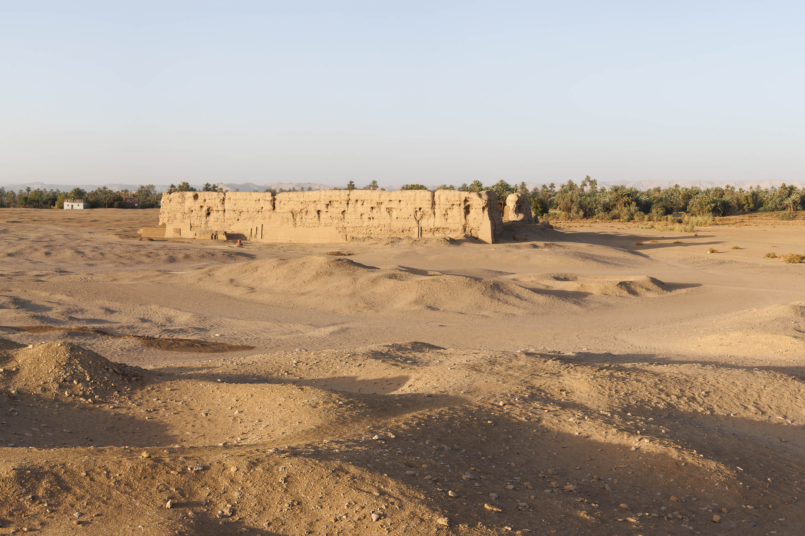
This giant mud brick enclosure is the most obvious landmark visible today at Hierakonpolis. Known from other sites in Egypt also, they seem to have enclosed an empty space.
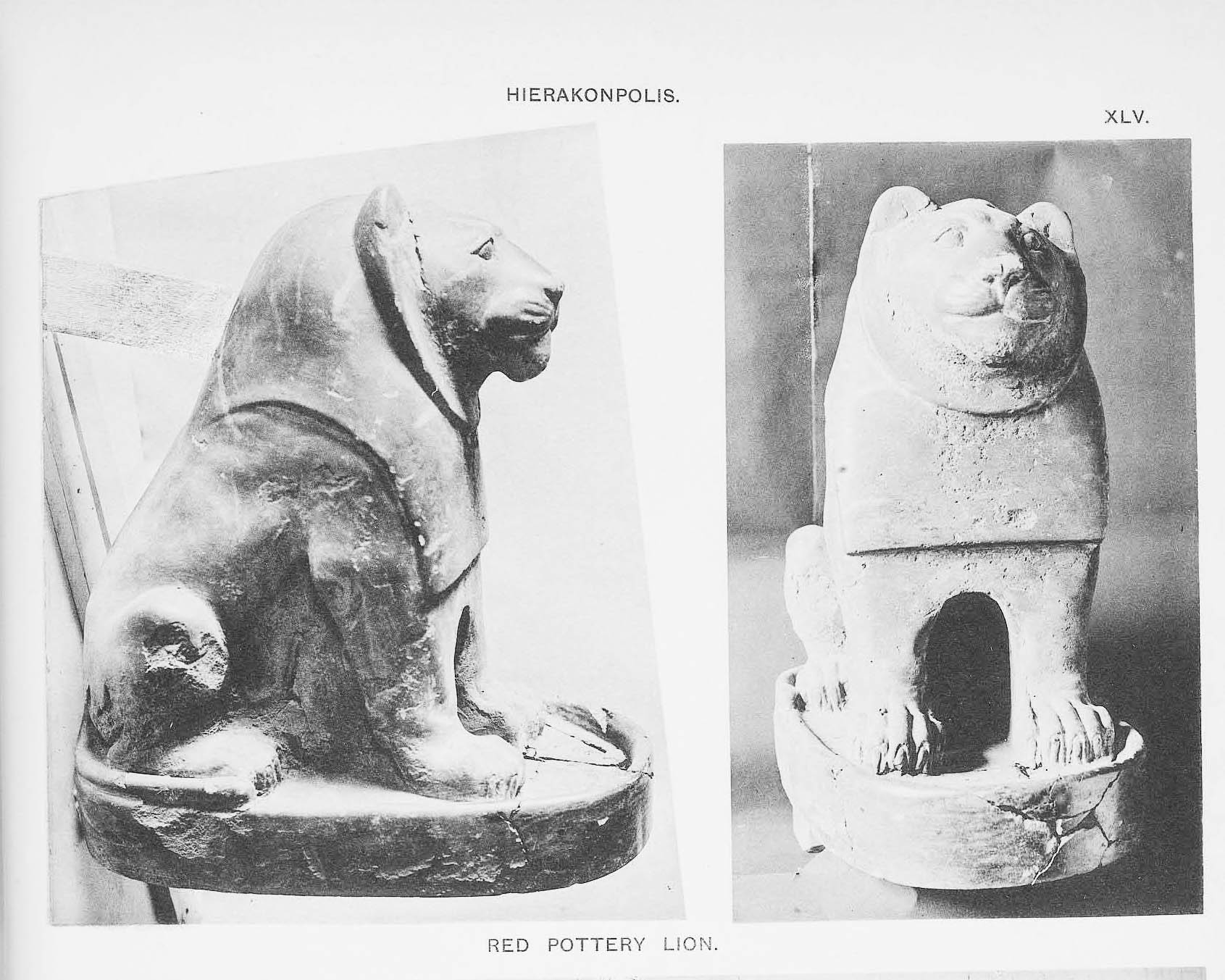
Excavations at Hierakonpolis were initiated by James Quibell and his assistant, Frederick Green, in 1893. Both men trained under Sir Flinders Petrie, a pioneer of archaeological methods and father of Egyptology. They began digging in the hills above the flood plain, next to the large mud-brick enclosure known as “the Fort.” However, they soon grew disillusioned by the lack of discoveries in this area and decided to focus their efforts on the mound in the floodplain instead. This wasn’t an obvious decision since the mound had for many years been robbed of stone and soil, which was used by farmers as fertilizer (sabakh). As it turned out, there was still plenty left to find on the mound. Within the first week of digging, they found the striking gilded head of a hawk. This would prove to be the first of many more exciting discoveries in the days to come.
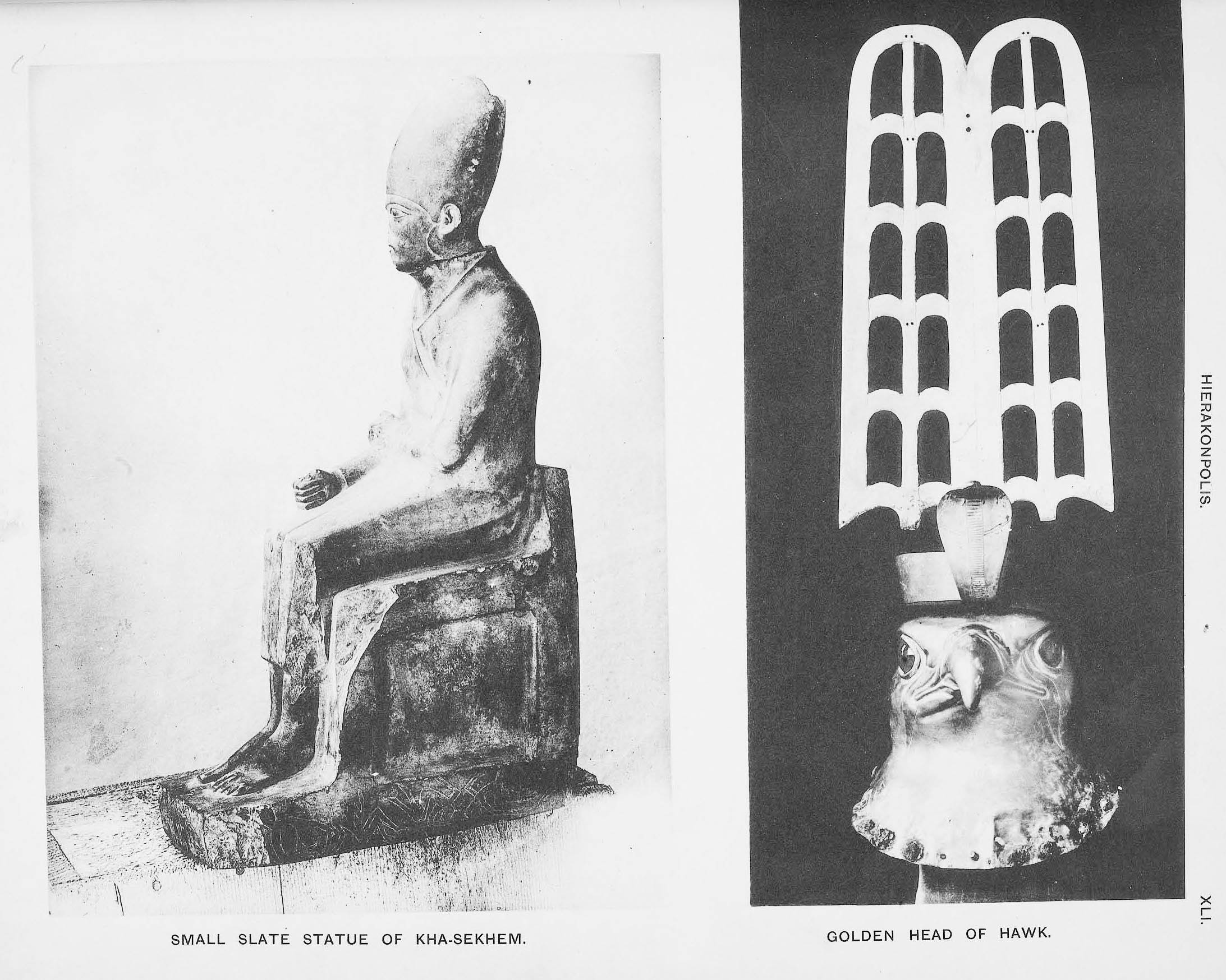
Some of the objects found in quick succession on the mound of Hierakonpolis during the first season, including the gilded head of a hawk.
Their most important discovery was a large cache of ivory and stone objects, known as the “Main Deposit,” which they found buried beneath the main temple on the mound. Most of the objects in the cache date to the earliest period of state formation in Egypt, including the most famous object in cache, the so-called “Narmer Palette.” The objects in the cache must have been removed from an early temple at the site during renovations and ritually buried beneath the foundations of the new temple.
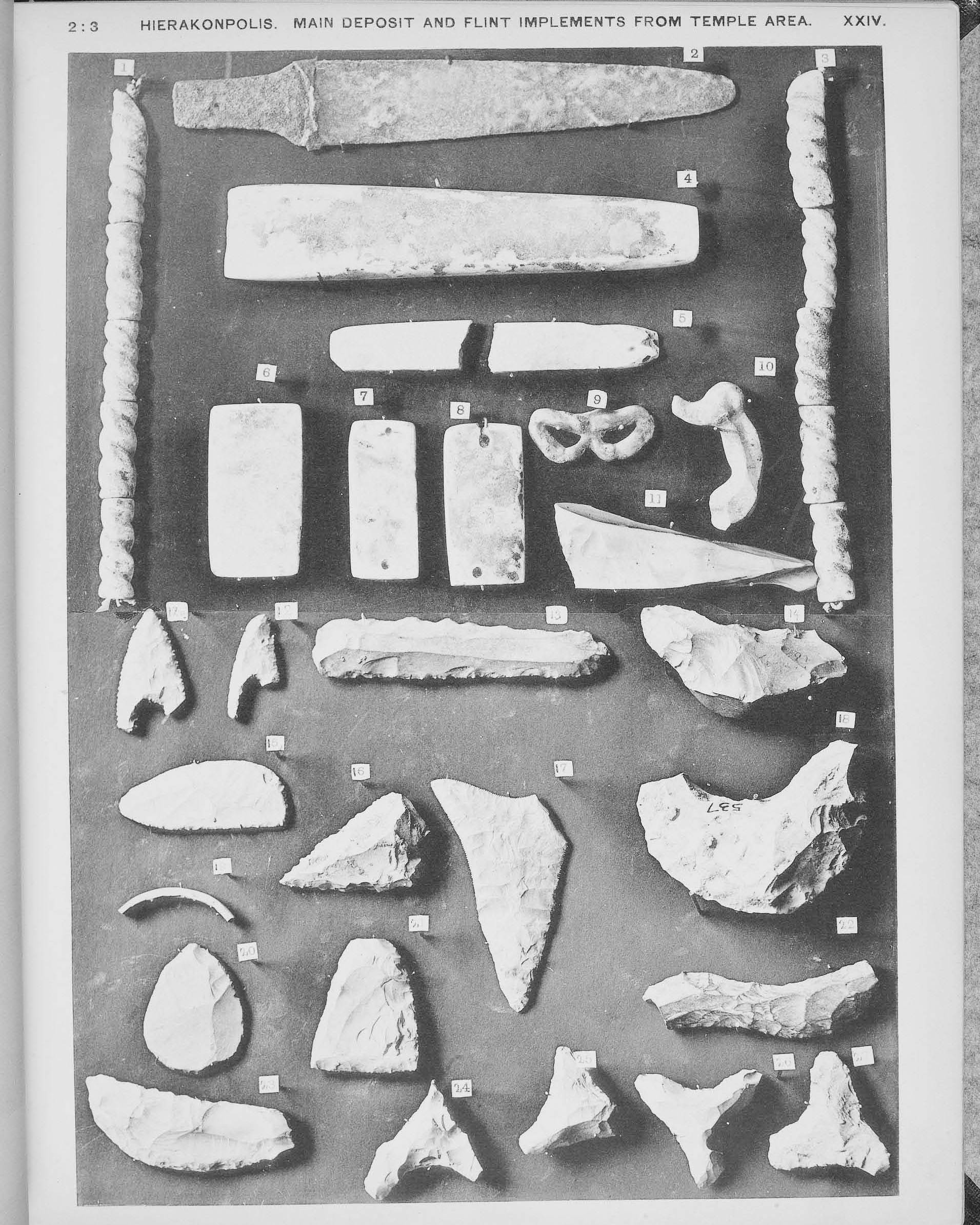
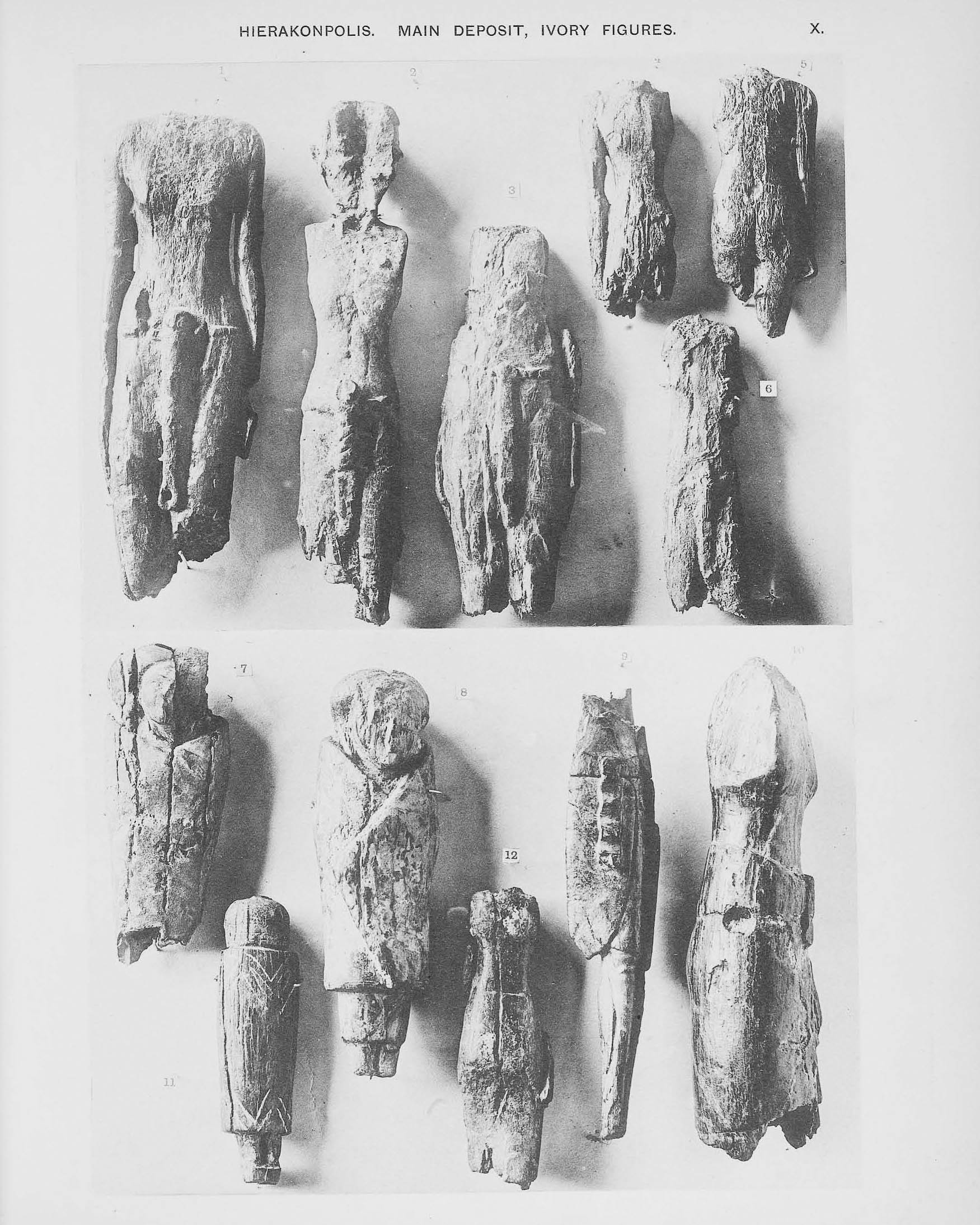
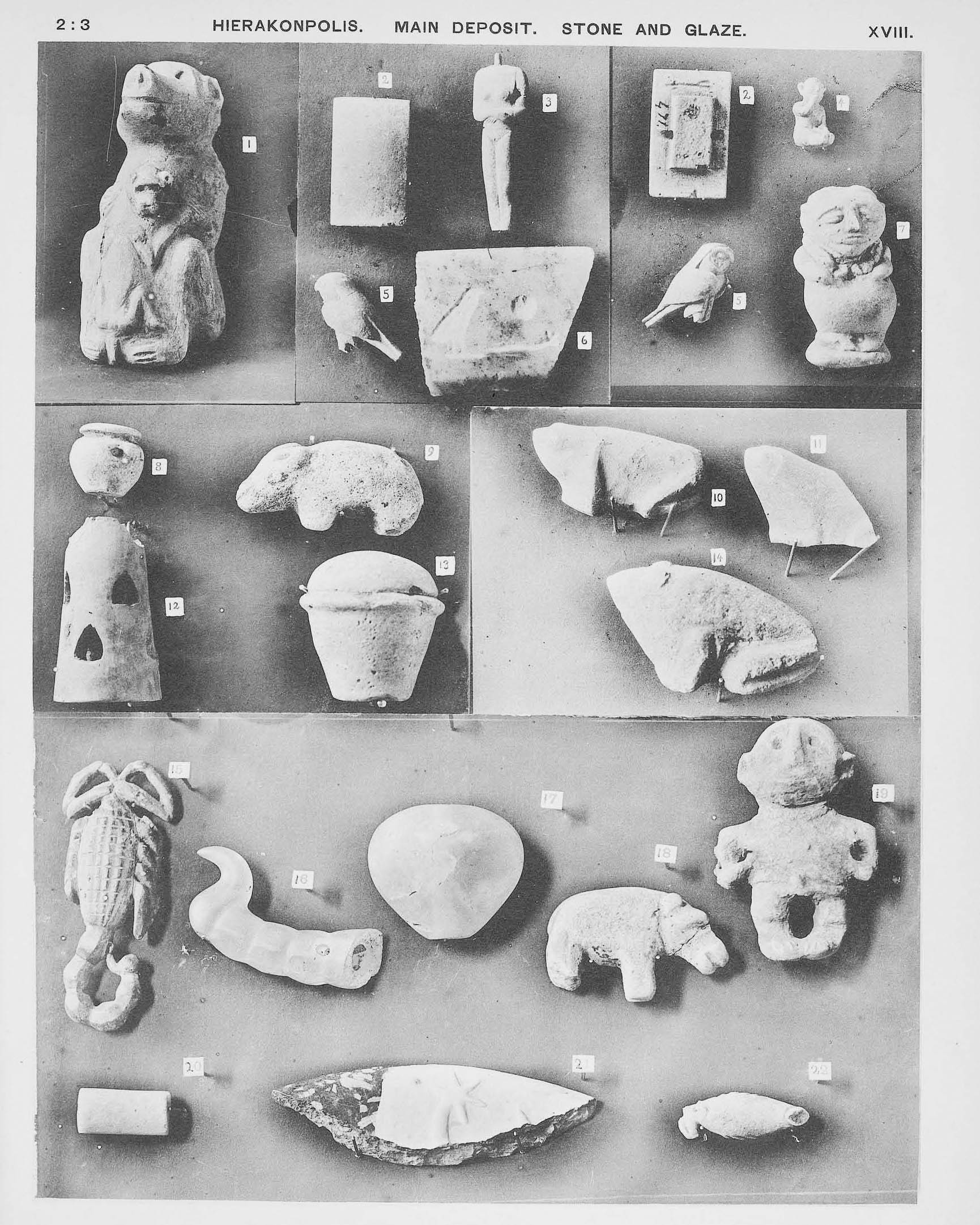
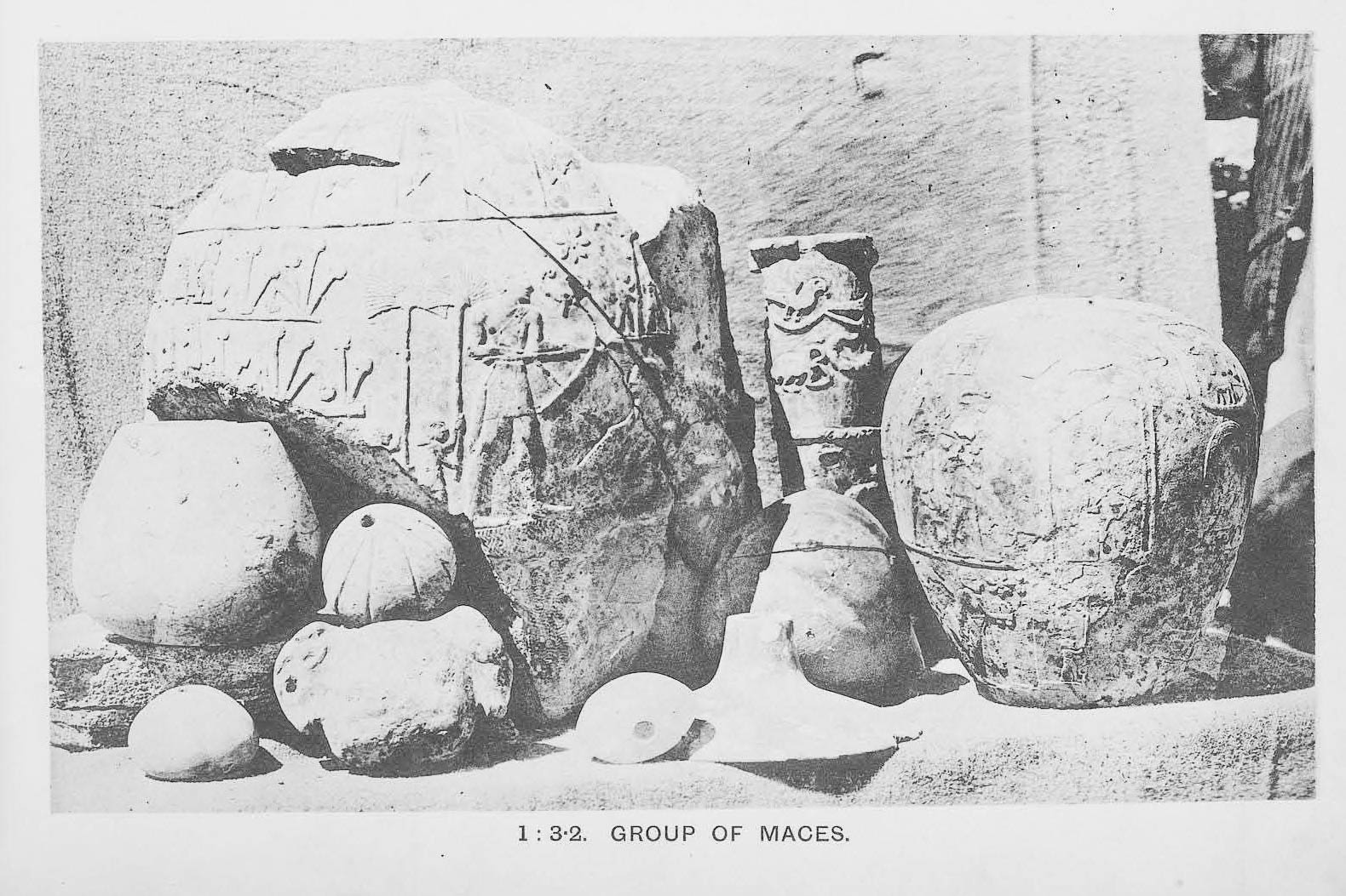
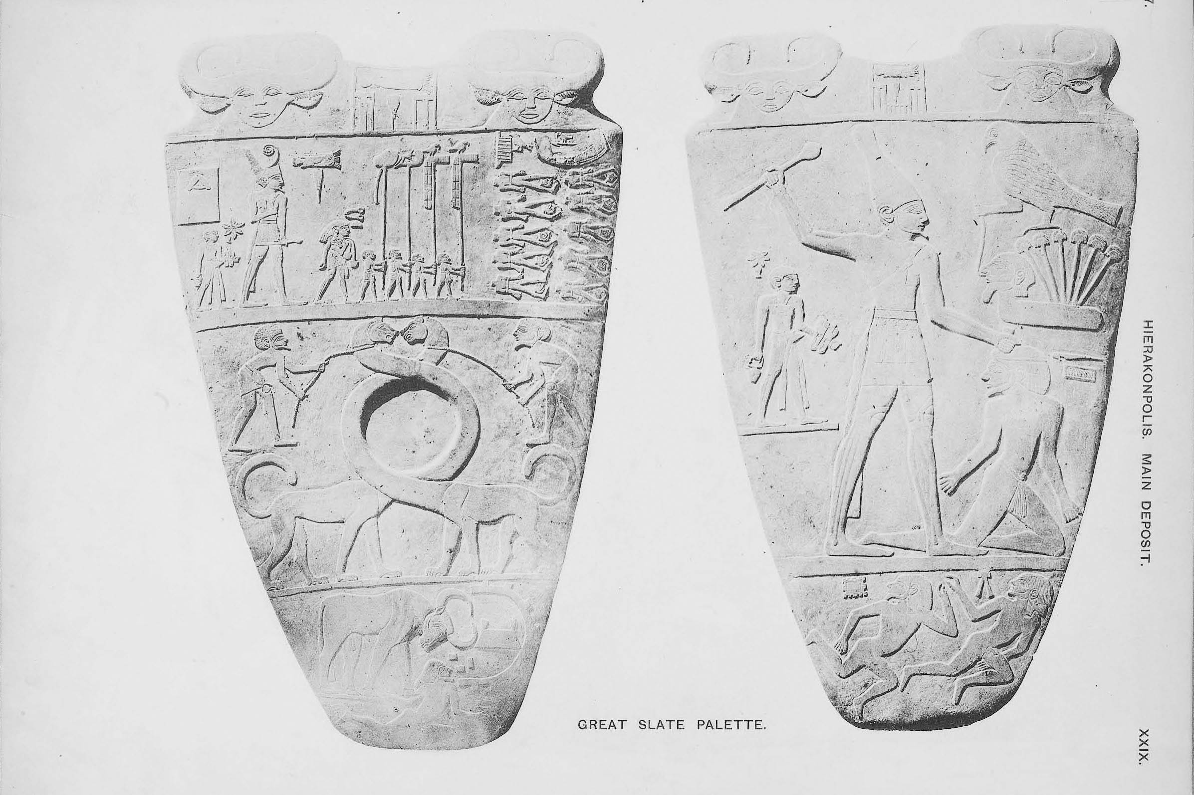
A selection of objects from the ‘Main Deposit’ including many finely work flints, large ceremonial maceheads, ivory figurines, and the Narmer Palette.
How far down?
Unfortunately, the earliest levels of occupation at Hierakonpolis lies beneath the water table and are, therefore, mostly out of the reach of archaeology. However, in 1984 the director of excavations, Michael Hoffman, drilled cores next to the mound and on the floodplain in order to determine how far down the occupation levels went at Hierakonpolis. The cores revealed thirteen feet of stratified deposits beneath the flood plain. More revealing was the extent of the ruins beneath the floodplain, which must have belonged to a city that once spread for a considerable distance across the floodplain.3“Through auguring and coring we have established the existence of about 4 m of stratified Predynastic settlement deposits under the Archaic levels at Nekhen and the surprisingly wide extent of those buried deposits under the modern floodplain…” See Hoffman 1989, 320
Breweries
Explorations in the desert behind Hierakonpolis, at HK11, have also revealed remnants of houses and workshops. Several large breweries were also discovered, each capable of producing an estimated three hundred gallons of beer per week.4Hierakonpolis Online The breweries found at HK11 are among the oldest discovered so far.5Hierakonpolis Online The Sumerians must also have operated large breweries, judging by the large quantities of barley recorded on their accounting tablets, but none have been found so far.
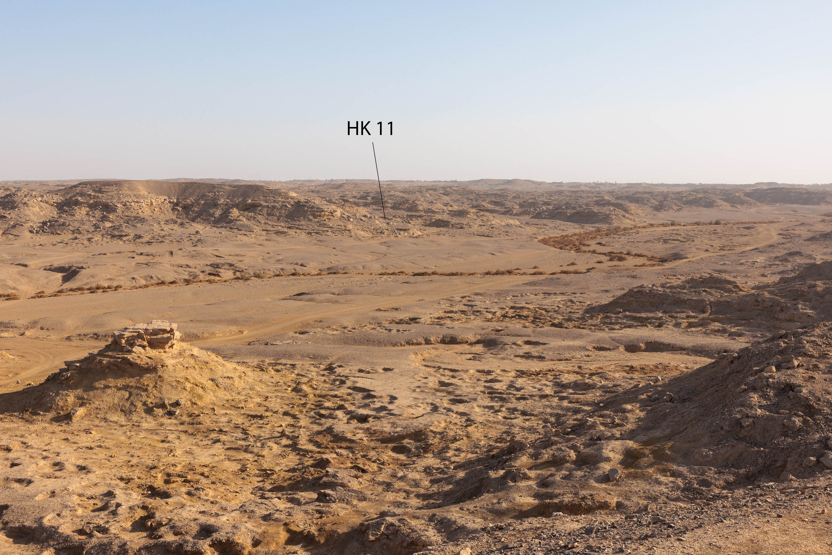
Located approximately a mile from the edge of the floodplain, the site designated HK11 covers 17 acres.
It now appears that not only did Hierakonpolis cover an extensive area on the floodplain but also extended for a considerable distance up the Wadi Abu Suffian. Hoffman concludes that agriculture during this period was not limited to the floodplain, but extended into the dry hills of the wadi.
Predynastic farmers… worked the land, now a stark desert wilderness, and then moved away, as suddenly as they had come. Since their departure, no farming people has ever been able to support itself this far from the Nile. For nearly two miles, their sites stretch out into the wastelands, defying explanation and contradicting some of our most cherished ideas about Predynastic patterns of settlement. Based on the work of an earlier generation of archaeologists, we have long seen Predynastic peoples as essentially river-bound—with their settlements perched on the low desert escarpments paralleling the rich alluvial soils of the Nile Valley proper. At Hierakonpolis, however, settlements extended both parallel and perpendicular to the river’s banks. Why?6Hoffman 1993, 156-157
Only a wetter climate can account for farming in the dry wadis of Upper Egypt, which in most years get no rain at all. Hoffman therefore argues that the period known as the African Humid Period, or more popularly as the period when the Sahara turned green, must have persisted well into the Early Bronze period.
For a time betwen 7000 and 2500 BC the deserts bloomed and human societies colonized areas that have been unable to support such dense populations since.7Hoffman1993, 161
As we will see in the next entry, this is not the only evidence of a wetter climate in Egypt during the Predynastic period.
Friedman, R.
“Hierakonpolis,” in Before the pyramids : the origins of Egyptian civilization, edited by E Teeter.
Chicago, Ill: Oriental Institute of the University of Chicago, 2011. Link
“HK24 – Breweries by the Cultivation.” Hierakonpolis Online. May 5, 2022. Link
Hardtke, F. E. “Rock Art Interpretive Approaches – Devising Frameworks to Maximally Utilize Independent Lines of Evidence.” Journal of Arid Environments 143 (2017): 22-47.
Hoffman, Michael.
“A Stratified Predynastic Sequence from Hierakonpolis (Upper Egypt),” in Late Prehistory of the Nile Basin and the Sahara.
: Poznan, 1989. Link
Hoffman, Michael.
Egypt Before the Pharaohs: The Prehistoric Foundations of Ancient Egypt.
New York: Barnes and Noble, 1993.
Huang, Jianbin, Shaowu Wang, Xinyu Wen, Bao Yang. “Progress in studies of the climate of humid period and the impacts of changing precession in early-mid Holocene.” Progress in Natural Science 18, no. 12 ( 2008,): 1459-1464. Link
Quibell, J. E., F. W. Green.
Hierakonpolis. Vol. II vols.
London: Bernard Quaritch, 1902. Link
Quibell, J. E., F. W. Green.
Hierakonpolis. Vol. I vols.
London: Bernard Quaritch, 1900. Link