Early farmers did not settle on the great alluvial flood plain of the Tigris and Euphrates, but in the small mountain valleys of the Zagros, in what is today Iran. This mountainous country which lies east of Mesopotamia was known to the Sumerians as “NIM,” which means “highlands.” The Akkadians referred to it as “Elam-tu,” which is shortened in the Hebrew Bible to “Elam.” In later periods the northern Iranian highlands were known as Luristan and the southern region as Fars (that is ancient Persia).
The Greek geographer, Strabo (1st century BC), observed that the climate of “Persis” has a threefold character:
- Coastal Region along the Persian Gulf—is “burning hot, sandy, and stinted of fruits except dates.”
- Elevated region east of the Persian Gulf (traditionally known as Fars)—”produces everything, is level, and is excellent for the rearing of cattle, and also abounds with rivers and lakes.”
- Northern Iran (traditionally known as Lurs)—is “wintry and mountainous.”
At the juncture of these three regions lies the broad Susiana plain, known today as Khuzestan, after “Huja,” the Old Persian name for Elam. Five rivers flow into the Susiana plain, most notably the Karkeh and Karun. Today, only the Karun makes the southward journey all the way to the Persian Gulf, merging with the Tigris and Euphrates along the way. Both the Karun and the Karkeh probably flowed directly into the Persian Gulf in ancient times. The Karkeh was a larger river back then, but its flow is thought to have already begun to decline by c. 1500 BC.1Potts 1999, 20
Strabo provides the following colorful description of the Susiana Plain.
…although Susis is fertile, it has a hot and scorching atmosphere, and particularly in the neighborhood of the city… when the sun is hottest, at noon, the lizards and snakes could not cross the streets in the city quickly enough to prevent their being burnt to death in the middle of the streets… this is the case nowhere else in Persis.2Potts 1999, 21
Strabo attributed the extreme heat of the region to the fact that the mountains north of the plain block the winds that would normally have carried away the suffocating heat. The region is still known for its extreme temperatures with summertime temperatures reaching as high as 138 F (58.9 C) yet dropping below freezing during the winter months. The wettest portion of the Susiana plain gets between 11 and 35 inches of rain each year, which is sufficient for dry farming.3Potts 1999, 15-20 Thus while the Susiana Plain is hot, it gets more moisture than 3-4 inches of rainfall received in southern Mesopotamia.

Delegation en Perse
Early explorers were attracted to the Susiana Plain by the ruins of the great Persian palace scattered across the surface of Susa, the Persian city which gave its name to the region. Here is where Queen Esther petitioned Xerxes for the life of her people and where the prophet Daniel saw the visions recorded in Daniel 8 and 9. But there is more to Susa than the ruins of the Persian city. South of the palace there is a high mound (Arabic. “tell“) that rises more than eighty feet above the plain. The French named it Tell de l’Acropole (“Mound of the Acropolis”). The French archaeologist, Jacques de Morgan, conducted an initial survey of the tell in 1891. Over the course of the survey, Morgan plucked strikingly beautiful, thin-walled, painted pottery from the mound. He would return six years later at the head of a French expedition, known as the Delegation en Perse, that would dig at Susa from 1897 until 1912.

A drawing of Susa by H.A. Churchill published by Loftus in 1857. It shows Susa before it was transformed by the excavations at the French expedition. The mound was flanked by the Karun and Karkheh rivers.
Susa I
M. de Morgan began excavating the tell by cutting terraces into its side at five meter intervals from top to bottom. He was surprised to discover that the beautiful figured pottery which he had pulled from the mound years earlier, came from the lowest levels of the tell. Remarking on trenches M. de Morgan dug into the mound, Henri Frankfort writes,
This proceeding revealed the astounding fact that the finest pottery belonged to the lowest strata in the mound, 25 metres below the surface.4Frankfort 1924, 23
The pottery was found exclusively in a cemetery which, although technically part of the mound, would have lain outside the city during its period of use. Although no one knew quite how old the pottery was, it clearly belonged to the earliest period of settlement at the site and thus was designated Susa I.5Frankfort writes, “As is well known, the existence of a stone age in the whole region of the Two Rivers is questionable.” (Frankfort 1924, 48) In addition to pottery, M. de Morgan found simple copper axes and mirrors in the burials. These items highlight the curious fact that the earliest burials at Susa were also the richest. Valuable items disappear altogether from subsequent burials in the cemetery.
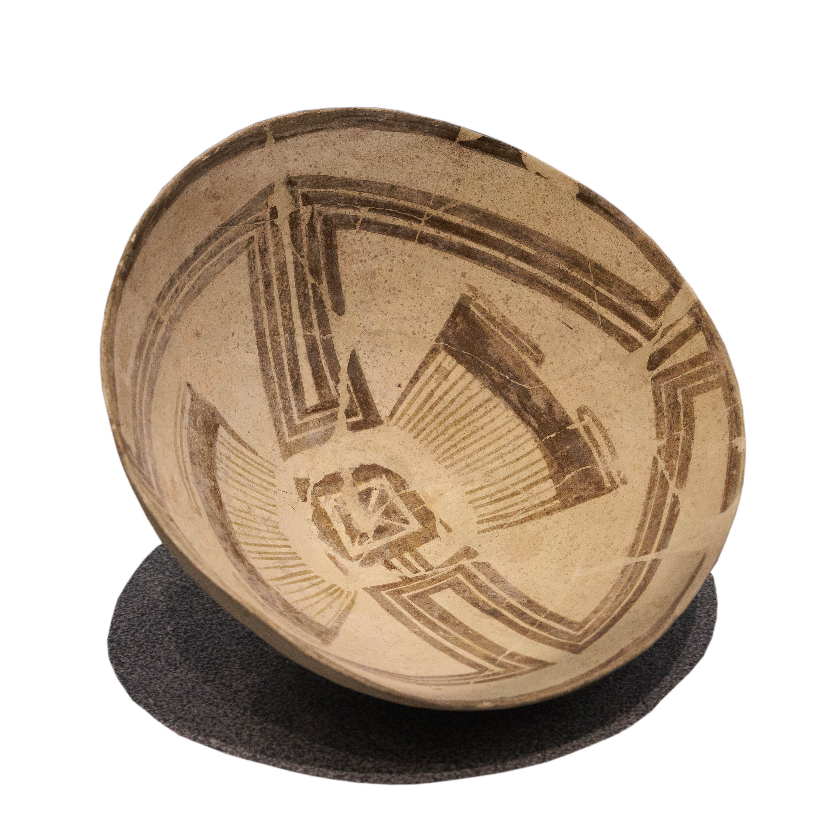
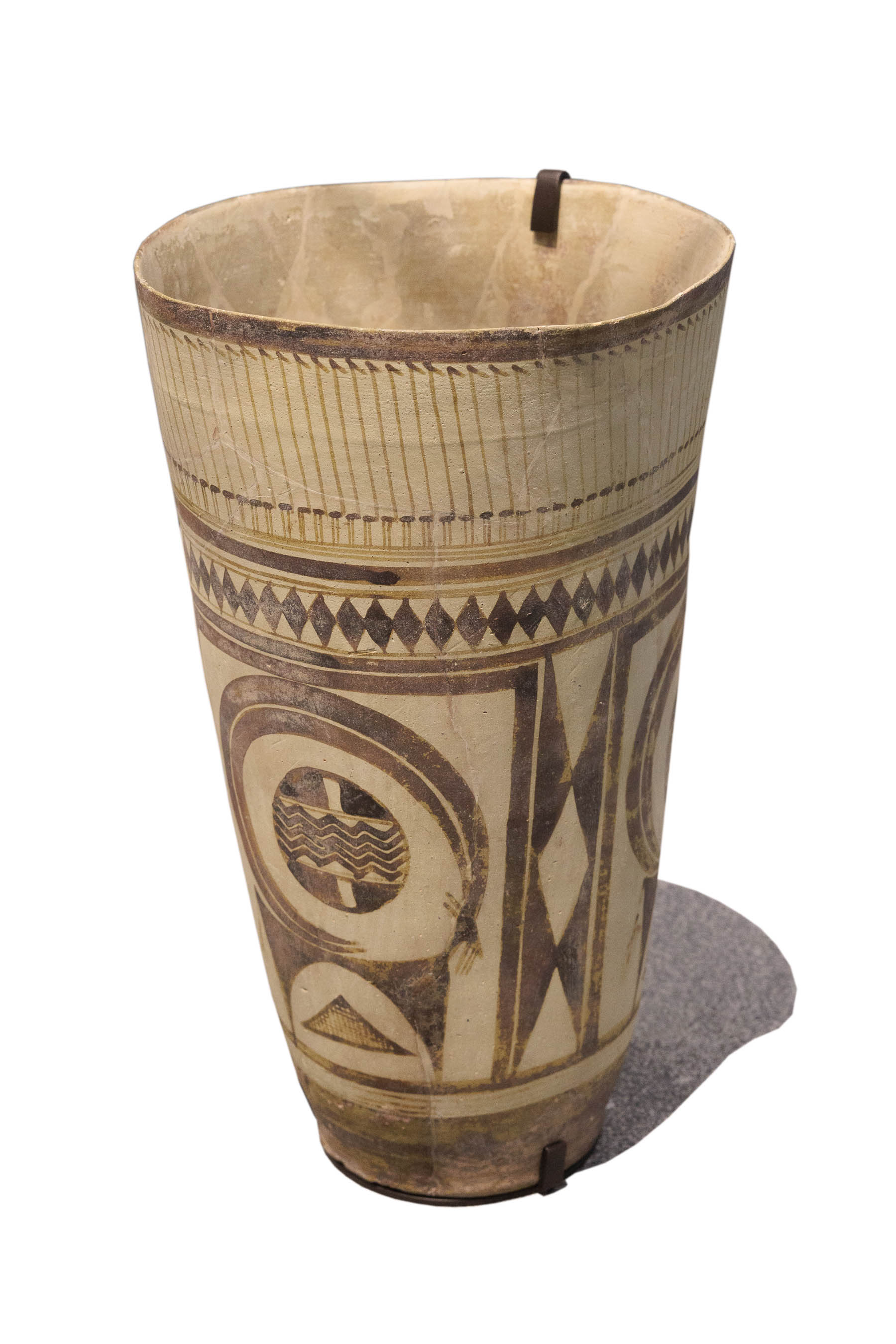
The pottery is hand-made and painted with rigidly symmetrical and linear figures. It was subsequently fired at low temperatures. It is quite porous and is, therefore, quite impractical for holding liquids.
The bowls and cups were fashioned on a “tournette,” a somewhat vague term generally used to refer to a slow-turning potters wheel. The light colored fabric of the vessel was created by adding lime to the clay. The vessels were fashioned with very thin walls and were fired at low temperatures, making them too fragile for daily use. The painted pottery was reserved exclusively for tombs. Frankfort suggested that the creators of this pottery may have sought to imitate leather vessels which might still have been preferred for daily use by a people accustomed to hunting and gathering.


The pottery styles displayed above are representative of the types of painted pottery found across a broad expanse of the ANE during the “Chalcolithic” period. They are decorated with distinctive geometric shapes in brown and red.
Susa II and III
Susa I is roughly contemporary with the Ubaid period in Mesopotamia, which was likewise characterized by buff-colored vessels decorated with geometric figures in brown or black paint. Furthermore, just as Susa I pottery was found in the lowest levels of Susa, so was Ubaid Ware found in the lowest levels of Uruk. Directly above Susa I (in levels designated Susa II and III) archaeologists found rather plain, but well fired pottery which clearly dates to the Uruk period. The presence of identical pottery in the levels of Uruk designated Uruk IV has led some scholars to argued that Susa may have been a colony of Uruk during the period of the Uruk expansion.6Algaze 2005, 14 ff.
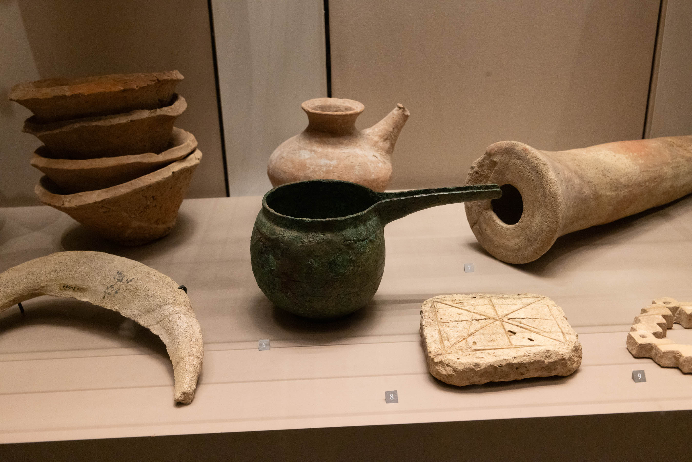


Top Left: Spouted jars, beveled-rim bowls and a clay cone. Bottom Left: Four-lugged pot. Right: Spouted jars.


The symbols which appear on these archaic accounting tablets from Susa appear to have been used primarily for their numeric value.
As noted previously, accounting tablets are an important marker of the Uruk expansion. Wherever Urukian merchants went, they brought their tablets, cylinder seals, clay cones, and bevelled-rim bowls with them. Judging by the archaic appearance of the accounting tablets recovered from Urukian colonies, including Susa, it may be argued that the Uruk Expansion occurred relatively early in the history of Uruk. The impressions in the tablets are made solely with the end of a round stylus. They lack all of the more complex proto-cuneiform signs found on the Kushim Tablet, for instance. Algaze argues that the Uruk Expansion coincides with Middle and first half of the Late Uruk period (Eanna VI-IVb) but ended before the last subphase (Eanna IVa). The Kushim Tablet should therefore be dated to this final phase of the Uruk period.7Algaze 2005, 56


How many years are represented by the three tablets displayed here? It is noteworthy, at least, that the tablet from Susa, which appears to be the oldest, was impressed with a Jemdet Nasr seal (of the “pig-tail” women type). But as we noted previously, these seals were likely in use already during the Late Uruk period.
Algaze, Guillermo.
The Uruk World System: The Dynamics of Expansion of Early Mesopotamian Civilization (2nd Edition).
Chicago, IL: The University of Chicago Press, 2005.
Frankfort, Henri.
Mesopotamia, Syria, and Egypt and their Earliest Interrelations. Occasional Papers, No. 6. vols.
London: Royal Anthropoligical Institute of Great Britain and Ireland, 1924.
Nissen, H. J. R.
The Early History of the Ancient Near East, 9000-2000 B.C..
Chicago: University of Chicago Press, 1988. Link
Potts, D. T.
The Archaeology of Elam : Formation and Transformation of an Ancient Iranian State.
New York: Cambridge University Press, 1999.
Speiser, Ephraim.
Mesopotamian Origins: The Basic Population of the Near East.
Philadelphia: University of Pennsylvania Press, 1930. Link